Imprescindibles
Ficción
No Ficción
Ciencias y tecnología Biología Ciencias Ciencias naturales Divulgación científica Informática Ingeniería Matemáticas Medicina Salud y dietas Filología Biblioteconomía Estudios filológicos Estudios lingüísticos Estudios literarios Historia y crítica de la Literatura
Humanidades Autoayuda y espiritualidad Ciencias humanas Derecho Economía y Empresa Psicología y Pedagogía Filosofía Sociología Historia Arqueología Biografías Historia de España Historia Universal Historia por países
Infantil
Juvenil
#Jóvenes lectores Narrativa juvenil Clásicos adaptados Libros Wattpad Libros Booktok Libros de influencers Libros de Youtubers Libros Spicy Juveniles Libros LGTBIQ+ Temas sociales Libros ciencia ficción Libros de acción y aventura Cómic y manga juvenil Cómic juvenil Manga Shonen Manga Shojo Autores destacados Jennifer L. Armentrout Eloy Moreno Nerea Llanes Hannah Nicole Maehrer
Libros de fantasía Cozy Fantasy Dark academia Hadas y Fae Romantasy Royal Fantasy Urban Fantasy Vampiros y hombres lobo Otros Misterio y terror Cozy mistery Policiaca Spooky Terror Thriller y suspense Otros
Libros románticos y de amor Dark Romance Clean Romance Cowboy Romance Mafia y amor Romance dramatico Romcom libros Sport Romance Otros Clichés Enemies to Lovers Friends to Lovers Hermanastros Slow Burn Fake Dating Triángulo amoroso
Cómic y manga
Novela gráfica Novela gráfica americana Novela gráfica europea Novela gráfica de otros países Personajes, series y sagas Series y sagas Star Wars Superhéroes Cómics DC Cómics Marvel Cómics otros superhéroes Cómics Valiant
eBooks
Literatura Contemporánea Narrativa fantástica Novela de ciencia ficción Novela de terror Novela histórica Novela negra Novela romántica y erótica Juvenil Más de 13 años Más de 15 años Infantil eBooks infantiles
Humanidades Autoayuda y espiritualidad Ciencias humanas Economía y Empresa Psicología y Pedagogía Filosofía Historia Historia de España Historia Universal Arte Cine Música Historia del arte
Ciencia y tecnología Ciencias naturales Divulgación científica Medicina Salud y dietas Filología Estudios lingüísticos Estudios literarios Historia y crítica de la Literatura Estilo de vida Cocina Guías de viaje Ocio y deportes
Philip Parker
Recibe novedades de PHILIP PARKER directamente en tu email
Filtros
Del 1 al 5 de 5
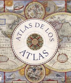
BLUME (Naturart) 9788419785114
* Un viaje desde los primeros intentos por comprender el mundo de las civilizaciones de la Antigüedad, pasando por el advenimiento de la cartografía comercial y los progresos tecnológicos que permiti
Ver más
Tapa dura
MA NON TROPPO 9788495601896
Tanto los guionistas profesionales como los que se inician en la escritura en general se encuentran, a menudo, con situaciones creativas y técnicas que han de resolver para avanzar en el guión.Este libro proporciona las pautas necesarias para redactar un buen guion y salvar esos escollos.
Ver más
Tapa blanda
HARPERCOLLINS PUB. 9780008506490
From the moment towns and cities arose, the struggle for land, resources and power has turned to violence. Almost from the start, maps have been an essential part of planning and waging war. History of War in Maps gives a unique visual representation of the development of warfare and the maps that have helped shaped our history.Each map in this beautifully designed volume plays a crucial role. While countless campaign strategies have relied on detailed and accurate mapping, entire wars have been fought over the maps themselves, with hopes of redrawing boundaries and redefining nations. Spanning more than 2,000 years, this book expertly curates more than 70 historical maps which tell the fascinating story of war: from ancient and medieval warfare to modern-day global conflicts.
Ver más
Tapa dura
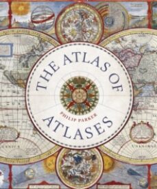
FRANCES LINCOLN 9780711268050
This beautiful book is a lavishly illustrated look at the most important atlases in history and the cartographers who made them. Atlases are books that changed the course of history. Pored over by rulers, explorers and adventures these books were used to build empires, wage wars, encourage diplomacy and nurture trade.Written by Philip Parker, an authority on the history of maps, this book brings these fascinating artefacts to life, offering a unique, lavishly illustrated guide to the history of these incredible books and the cartographers behind them. All key cartographic works from the last half-millennium are covered, including: The Theatrum Orbis Terrarum, considered the world's first atlas and produced in 1570 by the Dutch, geographer Abraham Ortelius. The 17th-century Klencke - one of the world's largest books that requires 6 people to carry it The Rand McNally Atlas of 1881, still in print today and a book that turned its makers, William H Rand and Andrew McNally into cartographic royalty.
Ver más
Tapa dura
EDICIONES OMEGA, S.A. 9788428215510
Desde los reyes hasta los políticos, de los filósofos a los revolucionarios, conozca a todas las personalidades que han configurado el mundo actual.
Ver más
Otros
Del 1 al 5 de 5


